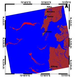
Oil spill, due to collisions or grounding of ships, is one of the most devastating forms of pollution in the marine environment. The impact of an accidental oil spill could be tremendous on marine ecosystem, coastal economy and other activities. Heavy vessel traffic in and out of the major commercial ports, such as Jawaharlal Nehru Port and Mumbai port has made the coastline of Mumbai vulnerable for oil spill incidents. The increased exploration of oil and gas activities in Arabian Sea puts Maharashtra coast is a potential threat for any oil spill accidents, which motivated the study to predict the spatial spread of an oil spill. Any successful mitigation measure to combat the spilled oil requires thorough understanding of their trajectories and spatial spread driven by the environmental parameters, such as winds and ocean currents.
A simple, user-friendly, yet technically validated, software toolhas been developed by our team under the financial support from Rajeev Gandhi Science and Technology Commission (RGSTC), Government of Maharashtra. With a simple click-away, user can predict the spatial spread of any oil spill along the Maharashtra coast. The accuracies of the software in estimating environmental parameters and spread of oil spill were tested with the information of past accidents (grounding of MVRAK, 2011 & collision of MSC Chitra and MV Khalijia, 2010), systematically obtained from satellite images and appropriate analysis.
As a part of the knowledge dissemination efforts, the software developed through this project has been distributed to various potential user agencies, such as Coast Guard, Maharashtra Pollution Control Board, Maharashtra Disaster Management Unit, Mumbai Port, Jawaharlal Nehru Port and ONGC to help in the effective migration or combating processes, in case of any future accidents.
Prof. R Balaji
