
Operational disaster analysis requires more than answering questions about an image. An AI system must bring together heterogeneous EO/GIS evidence, execute spatial workflows, coordinate specialized tools, maintain intermediate state, and ultimately produce grounded decisions.
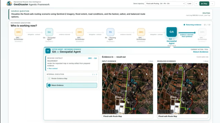
GeoDisaster is designed around this challenge. It introduces 2,921 verified instances across 43 question types and five task families: Deforestation Monitoring, Multi-Hazard Analysis, Building-Damage Assessment, Flood-Safe Routing, and Sentinel-1 SAR Flood Monitoring.
To enable this shift toward operational geo-intelligence, GeoDisaster brings together four key elements:
- Beyond static VQA. It integrates optical and SAR imagery with raster, vector, road-network, and exposure data through executable, deterministically verified geospatial workflows.
- Orchestrated multi-agent reasoning. A central Orchestrator coordinates specialized Geospatial, Visual Reasoning, and Planning agents across 18 disaster-oriented tools.
- Explicit execution contracts. Orchestrator–specialist interactions are governed by structured contracts, making delegation and intermediate execution grounded and verifiable, moving beyond free-form agent communication.
Role-Contract Expectation Alignment (RCEA). RCEA aligns agents with their assigned roles and contracts, improving tool use, evidence grounding, state consistency, and decision generation.
Together, these components enable strong answer accuracy and task success, with high step-level tool and argument correctness. Importantly, RCEA also transfers effectively beyond GeoDisaster, demonstrating the broader applicability of the proposed alignment framework. The work has been accepted at BMVC 2026.
Prof. Biplab Banerjee, Centre of Studies in Resources Engineering, IIT Bombay